Understanding the whitewater scale
What does it all mean?
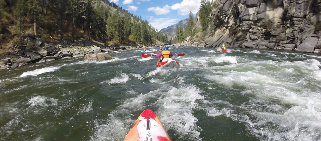
There are thousands of rivers around the globe with varying characteristics. In the 1950s, river running became popular as a recreational sport and it was deemed necessary to devise a system that would differentiate between the varying levels of difficulty, that rivers presented. A class system of VI was hatched by the American Whitewater Association. Given that the characteristics of rivers are the same, despite where the river is located, it was agreed upon that a scale should be instituted. Thus the whitewater scale was born. The Class I-VI scale took hold and has been used internationally, ever since. The design of the scale was based on technicality and consequence. For an in-depth explanation of the different classes visit the International Scale of River Difficulty.
The whitewater scale is meant as a general idea.
The whitewater scale was not designed with the expectation that the rating of a rapid or a river would ever be set in stone. As the river flows and changes so do our interpretation of the class system. What one boater thinks is a solid class III, another may think is an IV-. These opinions stem from varying levels of skill and experience. Also, rivers’ characteristics and variables change with time, natural events and volume.
Things that cause the ratings to change.
As a river rises and drops, the technicality of the rapids change, sometimes becoming easier and sometimes becoming harder. There are also variations in the rating system based on whether a river is a high volume river or a low volume river. A class III high volume rapid may have big waves and strong eddy lines as obstacles. A low volume class III rapid may have rocks and pour-overs as obstacles. Spring runoff or volume change may cause a rapid or an entire river stretch to change ratings on the scale by one or two whole numbers. The length of a rapid or of a stretch of river with a series of rapids linked together can dictate it’s placement on the whitewater scale. And water temperature and the location or remoteness of a river are factors as well.
The addition of ‘plus and minus’.
Because of the wide range of variables crammed into a small set of numbers, the + and – were added, to indicate whether a rapid or river stretch was on the easier side or the more challenging side of the scale.
In the Grand Canyon, a scale of 1-10 was created before the AWA developed the I-VI scale. Their thought was by having more numbers it would be easier to describe the difficulty of the rapid more accurately, thus using a number description instead of using a plus or a minus. Because of the history attached to the 1-10 scale, Grand Canyon has chosen to continue using this system.
What is CFS? Why are some rivers measured in FEET?
Most rivers are measured in ‘cubic feet per second’ (CFS), which is the depth x width x speed, a volume reading. The gauge is a fancy little contraption that spins around in the water to gauge the speed at a set point in the river where the depth and width are pre-measured. The Middle Fork and a few other rivers are measured in feet, in which the gauge is a measuring stick in the water at a set location with markings on it like a ruler. The handy aspect of this method is you can float by the gauge and visually see what level the river is at. With CFS, the gauge is digital and the information is sent via a transmitter to the internet at which point the public can view the current flow.
Why is the Middle Fork of the Salmon measured in feet?
Along its journey, the Middle Fork gains volume from over 100 tributaries which causes a change in the CFS regularly, sometimes 2 or 3 creeks within 100 feet of each other. As a result, in its 100+ mile journey, the CFS can range from 1,000 to 15,000. So if the gauge was at the beginning of the river it would not accurately reflect the CFS at the end of the river and vice versa. Because of this fact it is more user-friendly to measure the river in feet. With this method, the characteristics of the river can be learned according to where the river falls on the feet gauge even though the volume is growing as one travels downstream.
All wrapped up…
As you can see there are a lot of variables. Volume, location, length, water temperature, etc. Sometimes a class II can feel like a class V. There is no black and white, given that opinions, skill level, and mother nature are all players in the game.
Similar Posts by The Author:
- Blue Moon Yurt… RIVER TRIP MAGIC in Winter!
- Come Wine and Dine with Team Canyons!
- The Gift of a River Trip for Dad.
- Meet Velvet, A Dory on the Salmon!
- Offbeat Interview Series with Mike