Free-Flowing Rivers
The annual guessing game of a free-flowing river…..
One of the coolest things about a free-flowing river like the Middle Fork of the Salmon or the Main Salmon is that we never know exactly how mother nature will shed her water each year. The Middle Fork travels approximately 104 miles due north, through the largest wilderness area in the lower 48 states, the Frank Church Wilderness of No Return. On that journey, it drops 3,000 feet vertically. Starting at 6,280’ elevation and converging with the Main Salmon at 3,027′ elevation, the landscape changes from a high alpine forest to a high alpine desert. Along its course, over 100 creeks and springs feed the Middle Fork, increasing its volume 2-3 fold by the confluence with the Main Salmon. Therefore, predicting when and at what elevation all of the snow will melt off each year, is a bit tricky.
Spring Runoff
Due to the 3000′ elevation variance, the lower elevation snow tends to come off early and rather quickly, especially when coupled with major rain events, such as rain-on-snow. In 2010, Team Canyons was on the river for an early-season training trip when a rain-on-snow event caused the river to rise from 3 feet to nearly 9 feet in just over 24 hours. This was a historic event, due to the rapidity of this natural shed. Generally, upper drainages are slower to run off and can still be collecting snow well into June.
This year… the verdict is still out. Check out the current percentages here: Banner summit.
Early Season Logistics
One of the biggest things that can affect our logistics is whether the snowpack will hang out in the high country or create avalanches that block the road access into Boundary Creek, the put-in for the Middle Fork. If the road is closed on June 1st, then we have to launch from Indian Creek guard station, a point 25 miles downstream, that is only accessible by small backcountry planes. When this happens, and at low water as well, we use nearly 7 planeloads just to get our gear into the wilderness. This requires breaking down all of our frames and packing oars, coolers, boxes, kayaks and even our giant 18 and 22-foot boats, into small planes.
High Volume
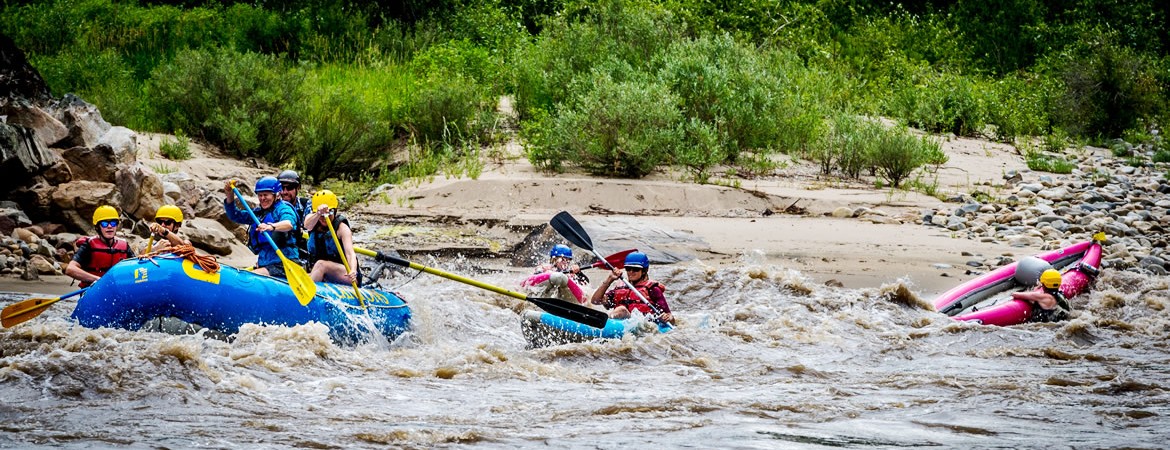
On the Main Salmon at high water, one can expect a fast, high volume, swirly river that rivals other great rivers of the west, in technicality and excitement, such as the Grand Canyon and Cataract Canyon. Our early June Main Salmon trips can be high adventure and super exciting if the spring runoff is big. This time of year is a great option for guests who have been on a river trip before. If the river volume exceeds our top-end cutoff, we will cancel (reschedule) a trip for safety reasons.
Watching and predicting the spring runoff is always exciting for river runners. We look forward to the excitement, the cleansing, and the anticipation. Stay tuned to see how this year’s water levels pan out. You can check our website for current levels on both the Middle Fork of the Salmon and the Main Salmon here: River Levels
High water is fast and fun and a bit on the chilly side. We highly recommend that you wear a drysuit (you can rent or purchase one online). If you are an adrenaline junkie, the early season might be a good choice for you!
Similar Posts by The Author:
- Blue Moon Yurt… RIVER TRIP MAGIC in Winter!
- Come Wine and Dine with Team Canyons!
- The Gift of a River Trip for Dad.
- Meet Velvet, A Dory on the Salmon!
- Offbeat Interview Series with Mike